Faculty of Architecture and the Built Environment
Delft University of Technology, Delft, The Netherlands
November 5, 2020
Notice: This workshop will take place online. This workshop is funded by NCG Talent Program 2020 and is free of charge for everyone. This workshop will be a parallel session of the NCG Symposium 2020.
Workshop details
Goal: This workshop tries to reduce the gap between owning some map data and publishing an interactive online map.
In the field of geodesy and geo-information, scientists have made a lot of multi-scale maps for different purposes. These maps are important for people to access the geographical information. Quite often, people need to download the map data and visualize it via a piece of software, which is inconvenient and uninteractive. It would be much easier for people to obtain the geographical information if the map would be published online and would be interactive (e.g., OpenStreetMap). However, extra technologies and knowledge are needed to make available the interactive online maps.
This workshop consists of two tutorials, the programme can be found below. After participating in this workshop, participants will be able to make an interactive map of 3D city models using a part of Den Haag Open Data and to make an interactive vario-scale web map of area objects using our data.
Programme (November 5, 2020)
The complete programme is available here.
- Interactive map of 3D city models (14:00–14:40), Prof. Dr. Volker Coors, Stuttgart Technology University of Applied Sciences, Germany.
- Convert CityGML data to 3D tiles and visualize the 3D tiles in a cesium client.
- Access the 3D tiles data set from a webserver using the 3D GeoVolume API developed in an OGC pilot this year.
- Give an example of an open source implementation of the 3DPS; but this will be homework due to time constraints.
- Materials for the tutorial, prepared by MSc. Joe (Thunyathep Santhanavanich).
- Interactive vario-scale web maps (14:40–15:20, slides), Dr. Dongliang Peng, Delft University of Technology, The Netherlands.
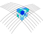
- Use Paraview to view the 3D Space Scale Cube (SSC) of an example vario-scale web map.
- Download "ssc_example_view.zip", extract the files, and put them in folder "C:\ssc_example_view".
- Open file "ssc.pvsm" with ParaView to view the SSC.
- Open file "sscgen_smooth_paraview_parallel_event.obj" with a text editor to see how to organize the vertices and faces.
- Use server Apache to host the vario-scale web maps, where a web map is realized by slicing the SSC.
- Download "Apache24.zip" and extract the files.
- In the extracted files, find "readme_first.docx" and follow the guidance in the document.
- Interactively view the vario-scale web map with a web browser (preferably Google Chrome).
- Interactively view a vario-scale web map of a real data set.
- Interactively view a comparer of vario-scale web map of a real data set.
- Homework: use GitHub to host the vario-scale web map so that other people can view your vario-scale web map anytime.
Preparation
- Please install sofware FME Desktop, where you can get a free license for Home Use.
- Please install server Apache Haus, which is for free.
- Please install sofware ParaView, which is for free.
Registration
To register, please send an email to Dongliang Peng (d.l.peng@tudelft.nl). He might send you more information about the workshop.
Further information
Please feel free to contact Dongliang Peng if you have any questions or if you would like to give a presentation.
Workshop Organizer
- Martijn Meijers, Delft University of Technology, The Netherlands.
- Peter van Oosterom, Delft University of Technology, The Netherlands.
- Dongliang Peng, Delft University of Technology, The Netherlands.

